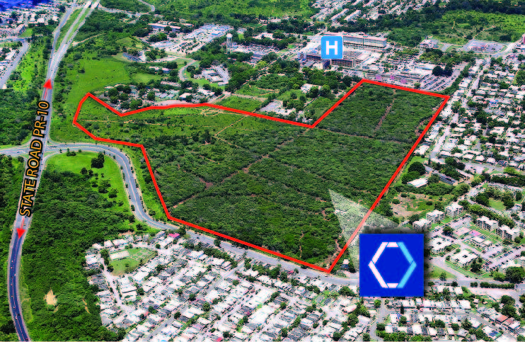
San Lucas Land, Ponce- FOR SALE
PR-10, Ponce 00716
| Land Size | 343,277 Square Meters |
| Zoning | EV.4- allows multiple uses |

Description:
Development site consisting of a combined total approximately 87.34 cuerdas, equivalent to 343,277.71 square meters, separated into two (2) parcels and located adjacent to the San Lucas Hospital in Ponce.
Location:
Intersection of State Road PR-10 & Emilio Fagot Avenue, Machuelos Ward, Ponce, Puerto Rico
Zoning:
EV.4 - Allows for residential, commercial, insitutional and light industrial uses
Site Area:
Parcel A: 67.47 cuerdas, equivalent to 265,168.76 square meters
Parcel B: 19.87 cuerdas, equivalent to 78,108.95 square meters
TOTAL: 87.34 cuerdas, equivalent to 343,277.71 square meters
Location Influence:
Located off of State Road PR-10 in Ponce, adjacent to the San Lucas Hospital.
In the immediate vicinity of many residential, commercial and institutional uses, including residential developments, stores, retaurants, fast food establishments, hospital, retail centers and office buildings, among many others.
Site Coordinates:
Latitude: 18°02’02.96”N, Longitute: -66°35’55.85”W
Tax Code ID (CRIM):
365-000-008-69-901
The information contained herein is from sources deemed reliable, but is subject to errors, omissions, and withdrawal without notice.


