50 Cuerdas for Sale in Juncos
$300,000 REDUCED
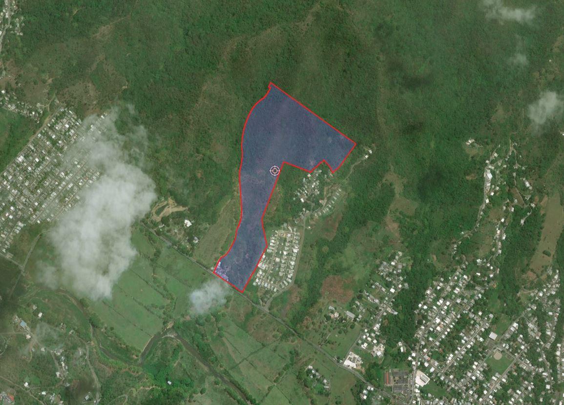
PR-31, Juncos 00777
| Land Size | 48.56 Acres |
| Zoning | (B-1) 57%; (A-D) 43% |

Vacant raw land comprising an area of 50 “cuerdas”. The property is located State Road PR-31, Km. 21.3 in the Gurabo Arriba Ward of the Municipality of Juncos, Puerto Rico. The subject property is within zoning districts identified as SREP (Rustic Soil Especially Protected) SRC (Common Rustic Soil) with zone districts as A-D, (Rural Developed Area), 57% and B-1 (Interior Forests Area), 43%. Under SRC and SREP the permissible uses are mainly agriculture and preservation, with some residential uses of one or two families residential units permitted per tract of land of more than 5 “cuerdas”.
Mostly hilly to sloping with some level areas.
Location:
North of Road PR-31, Km. 21.4, Gurabo Arriba Ward Juncos, Puerto Rico
Coordinates:
Lat: 18.24378532, Lon: -65.88572099
-
Office Phone: (787) 778-7000Mobile: (787) 439-8884
-
Office Phone: (787) 778-7000Mobile: (787) 518-6676


The information contained herein is from sources deemed reliable, but is subject to errors, omissions, and withdrawal without notice.