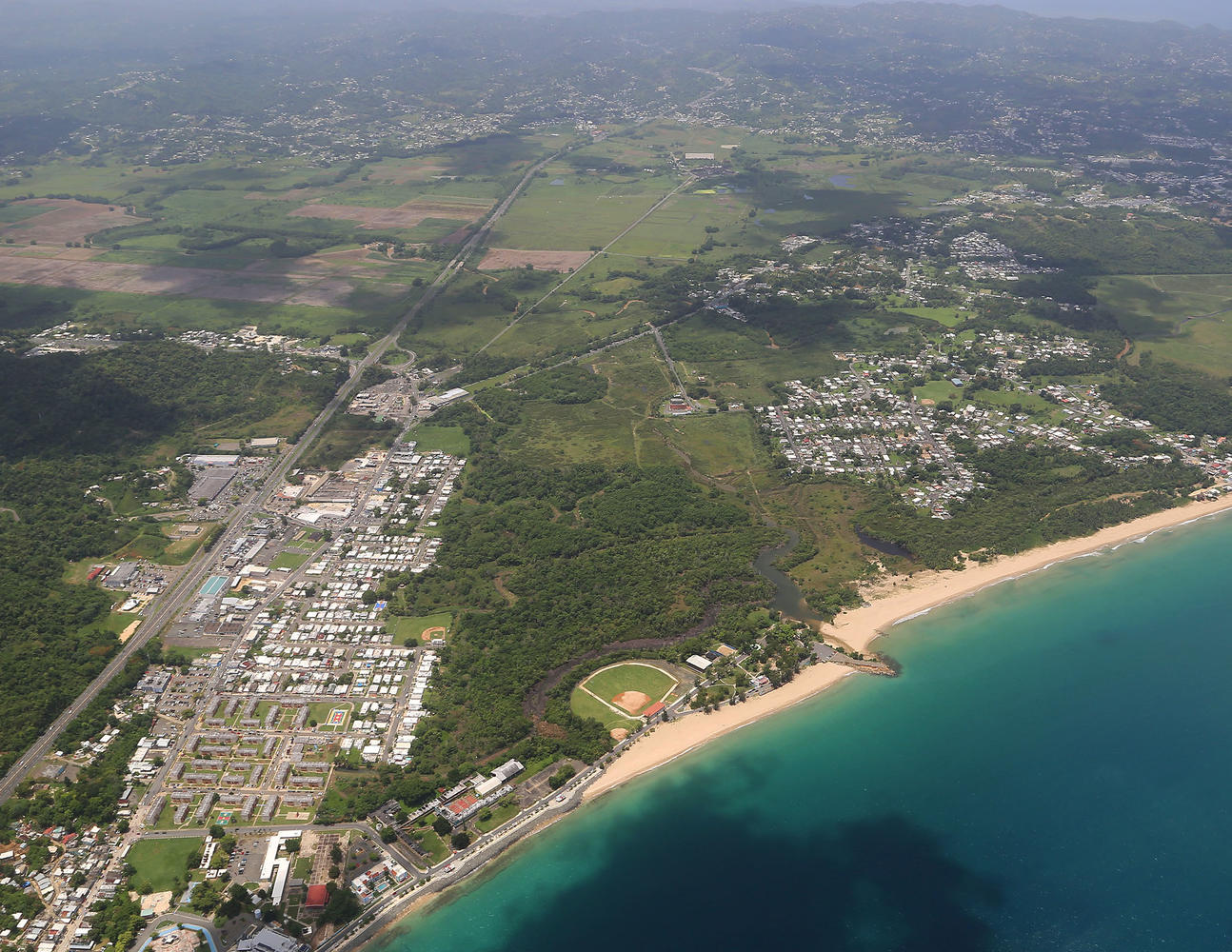
225 Acres Agricultural Land Bordering River
$2,500,000 OBO
Aguada/Aguadilla Border, Aguadilla 00603
| Land Size | 228 Acres |
| Zoning | Conservation and Preservation |
| GPS Coordinates | 18.413506 N, 67.163149 W |
| Floodway | Yes |
| Land Size | Over 200 acres |

Description: Privately owned west coast waterfront land bordering Culebrinas River with frontage to Aguadilla Bay, between the municipalities of Aguadilla and Aguada. The easily accessible land has direct access to State Road PR-115 to Rincon and State Road PR-2 to San Juan. Existing improvements include a commercial and/or residential 4-room concrete structure with an adjacent 40 x 40 concrete floor, maintenance facility with a high roof. The beachfront land component is currently being utilized for agricultural purposes to raise free-range high-quality beef cattle making it the ideal location for agricultural or any limited impact use.
Key property boundaries are Espinar Ward with Rio Culebrinas on one aside and Caño Madre Vieja on the other side with State Road PR-2 to the West and the State Road PR-115 to Rincon, also crosses on both sides of the property.
Strategic Location: Located at Aguada / Aguadilla border between Aguadilla's International Airport and the municipality of Rincón. It is located less than 8 miles south of the International Airport.
Highlights:
- Motivated Seller
- Zoning: 069-000-003-01-998 (CR-70%, PR-16% & AR-1-13%), 045-000-009-31-998 (CR-92%, AD-7% & I-L-1%), 069-016-548-09-000 (AR-1 100%) & 045-000-007-02-000 (PR-97% & CR-3%)
- Property tax id: 069-000-003-01-998, 045-000-009-31-998, 069-016-548-09-000 & 045-000-007-02-000
- Site Coordinates: 18°24'35.6"N 67°09'45.9"W
- Site Area: Approx. 225 acres
- Strategic Location: Located at Aguada / Aguadilla border between Aguadilla's International Airport and the municipality of Rincón. It is located less than 8 miles south of the International Airport.
- Approximately 300 feet beachfront
The information contained herein is from sources deemed reliable, but is subject to errors, omissions, and withdrawal without notice.


