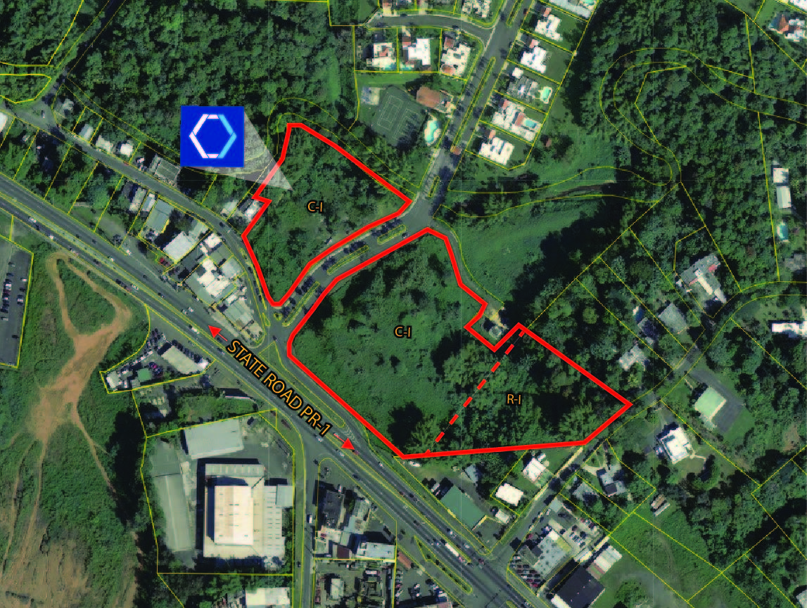
State Road PR- 1 Development Site - FOR SALE
PR-1 km 26.8, Caguas 00725
| Land Size | 31,636 Square Meters |
| Zoning | C-I & R-I |

Description:
Two vacant land parcels, with strong development potential consisting of apporximately 31,646.13 square meters, equivalent to 7.82 acres, with excellent frontage to State Road PR-1, Rio Cañas Ward in Caguas.
Location:
Km. 26.8, State Road PR-1, Rio Cañas Ward, Caguas, Puerto Rico
Site Area:
Approximately 31,646.13 square meters, equivalent to 7.82 acres
Site Coordinates:
Latitude: 18°18’4.30”N, Longitude: -66° 3’41.56”W
Location Influence:
Excellent accessibility and visibility from State Road PR- 1 at the entrance to Laderas de San Juan residential neighborhood with immediate access to major traffic artery Luis A. Ferre Expressway.
Densely populated urban neighborgood surrounded by many supporting commercial, residential and industrial uses. Specifically, close to UPS & Walmart distribution centers, gas service stations, light industrial, warehouse, logistics operations, among others.
Zoning:
C-I (Intermediate Commercial) 73%
R-I (Intermediate Residential) 27%
Property ID (Tax code number):
172-021-431-29-000 & 172-021-407-96-000
The information contained herein is from sources deemed reliable, but is subject to errors, omissions, and withdrawal without notice.


