176 Acres of Residential Development Land
$3,600,000
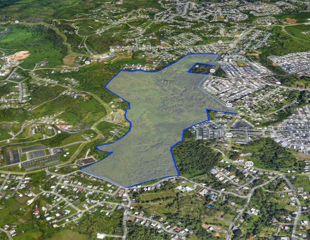
West of Km. 0.7, PR-828, Piñas Ward, Toa Alta 00953
| Land Size | 176.09 Acres |
| Zoning | R-I Medium-Density Residential |

Click here for video: https://youtu.be/GrmEPolCn98
This 176-acres vacant land parcel is specifically located west of and across the street from the Toa Alta Heights residential subdivision, and about 1.2 miles from the boundary limits with the Bayamón Municipality. As such, the Property is mainly influenced by the economics of the Bayamón Municipality, benefitting from a densely-populated neighborhood with excellent access routes and good supporting commercial and institutional uses.
The Property was once approved for the development of a single-family residential subdivision to be known as Finca Valiente, consisting of 950 units distributed within four (4) different phases. All main basic utilities and infrastructure needed for the future development of the Property are present in the vicinity.
Don't miss this excellent residential development opportunity!
Highlights:
- Asking Price: $3,600,000 or Best Offer
- Property tax ids: 112-000-002-93-901; 112-035-569-17-000 & 112-045-318-06-000
- Land Area: 712,635.36 Square Meters equivalent to 181.31 cuerdas and/or 176.09 acres
- Annual Property Tax Expense: $5,047.52
- Zoning: R-I (Medium-Density Residential) & UR (Developable Terrain)
- Permits: Once approved for the development of a single-family residential subdivision to be known as Finca Valiente, consisting of 950 units distributed within four (4) different phases.
Utilities/Infrastructure: All present in the vicinity. - Flood Zone: X (non-floodable area)
- Coordinates: Lat: 18.35851075, Lon: -66.22176642
- Topography: Level to rolling, at grade with access arteries.
-
Office Phone: (787) 778-7000Mobile: (787) 439-8884
-
Office Phone: (787) 778-7000Mobile: (787) 518-6676


The information contained herein is from sources deemed reliable, but is subject to errors, omissions, and withdrawal without notice.